Sunday, July 31, 2005

Sodus Bays

Rochester to the Sodus Bays

Our sail from Rochester to Big Sodus Bay was uneventful with the expected light east wind in our face. We arrived in the late afternoon and anchored off a protected west shore of an island…. a lovely spot with many fishermen quietly coming and going. We settled in for the evening having snacks, making dinner, eating at dusk, and waiting for the stars to appear. We were the only sail boat on this side of the bay but did notice 4 or 5 sailboats anchored across the bay on the east shore. Hmmmm. Why would they want to be on a lee shore?

The next morning the wind had picked up and sure enough was now coming out of the west and we were on the lee shore. As the coffee was just starting to perk, Scott noticed that we were no longer swinging on our anchor but drifting toward shore. Start the engine and head for the other side of the bay. We joined the little nesting of sailboats as quietly as possible. It was only 7:30 in the morning. Then finished brewing coffee and planned the rest of our day.

We noticed two of the sailboats head out to the big lake. Shortly afterward one of them returned. We lowered our outboard onto the dingy with the main halyard and headed over to say hi and see what the deal was before riding into the town of Sodus Bay, if there was one.

The captain of the Pearson 36 said that they decided not to tackle the 20+ knot winds head on and they could wait another day before heading west toward Rochester. We totally agree with that approach to sailing. We continued our dingy ride into Sodas Bay and found the yacht club where, as you’ve read, we updated our blog and caught up on email. Later that afternoon back on Enee someone was driving his dingy our way. It was captain Pearson inviting us over for a cold one. We had great conversation and lots of laughs with Don and Mary of s/v Merry Mary. Look forward to seeing you in Hilton Head!

The next day we sailed the short 12 miles to Little Sodus Bay passing impressive sandy cliffs and trying to catch the light breeze from behind in our sails. As Mary recommended we anchored in Meadow Bay. We dingied over to Fair Haven where we found a friendly place to have a Labatt’s Blue. The sign outside said: Welcome campers, bikers, and fisherman. We didn’t tell them we were sailors.

Today we decided to take a slip at the Fair Haven Yacht Club. We needed to look at our water tank once again. After only 3 days we were out of water! What is this puzzle all about? There are two questions: does the tank leak and how much water does it really hold? Mr. Science was all over this one. We timed how long it took to fill our 5 gallon jerry can; 100 seconds. This means, in theory, that it will take 10 minutes to fill our 30+ gallon flexible water tank. Ok. Let’s begin. We remove all of the bedding and cushions, take out the sails stored under the v-birth and remove the water tank. We empty all of the water, use the GPS as a timer, ready – set – go! 5 minutes into the experiment we couldn’t position the tank on the deck to hold any more water. This approach clearly wasn’t going to work. We did observe that the fittings were not leaking so back into the boat she goes. This time Scott was able to fill 7 ½ minutes worth of water when the fill hose filled with water. Gots to mean that the tank is full, but not with the 30+ gallons advertised. So how much water does the tank really hold? This is your math problem for the day.

Tomorrow we leave at the crack of dawn, really, and head to Oswego, NY; another 12 mile trip. We want to get to the marina as early as possible and begin the process of unstepping the mast. I don’t even want to think about the amount of graciefur that’s back among the bracing boards. How much is a graciefur worth anyway? Perhaps a math question for another day.


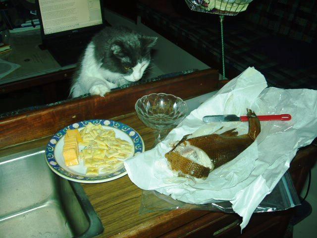
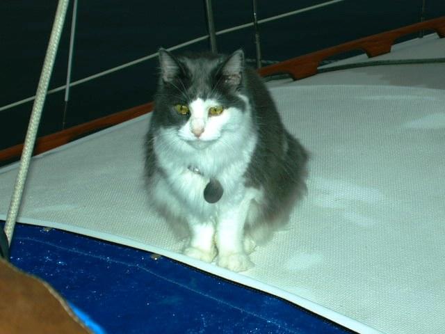
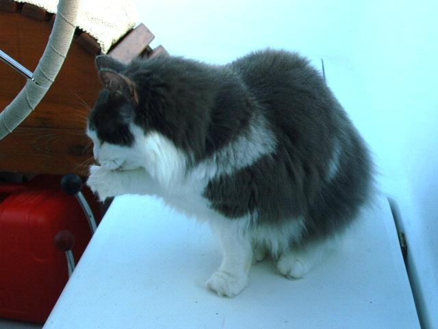
Gracie awaiting her share of snacks. Yes that is smoked white fish she is eyeing.


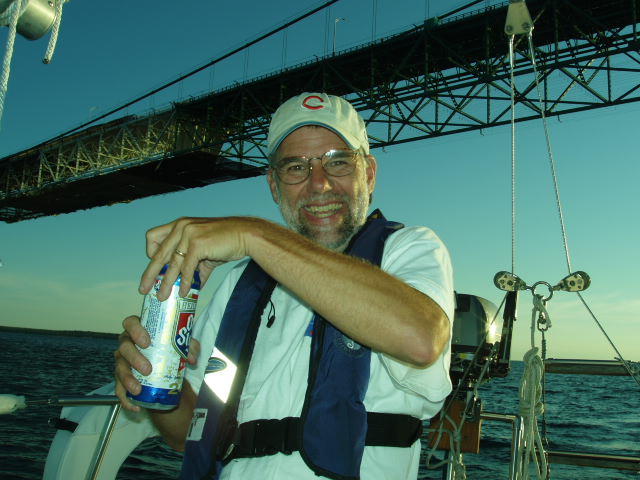
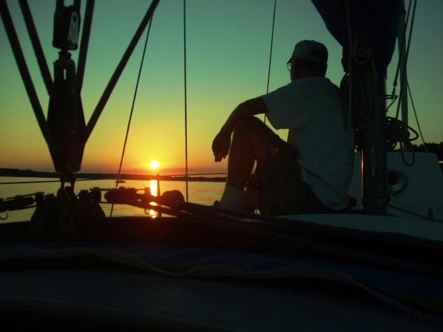
Scott enjoying a beautiful sunset with the fishermen.


The cliffs on the way to Sodus Bay.
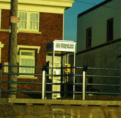
Friday, July 29, 2005

Niagara River to Sodus Bay, NY

Hello to all! As the following blog will say as well we've managed to get connected via the nice people at the Sodus Bay, NY Yacht Club. This blog will take you across the southern shore of Lake Ontario. After this one is our depiction of traversing the Welland Canal. As usual... pics at the end and COMMENT AWAY!

As we entered the Niagara River we called in to the yacht club planning to put our Burnham Park burgee to use. Our initial radio attempts didn’t receive any response. (It seems that a huge regatta had just ended and they were busy with tallying results.) As we approached the area we noticed a few sailboats on the hook along the eastern shore of the river. Well, let’s see how our anchor will hold. It’s been about 4 hours and we’re still holding even in 15 knot winds at times. The question now is, should we set the second anchor?

So nice to swing on the anchor with a view looking south up the Niagara river and north toward the fort. Tomorrow could be a long one going 60+ miles to Rochester. Weather permitting. But, that’s tomorrow.

Maybe I should have set a second anchor. We wake up around midnight with the wind really howling and Enee straining at her anchor rode. We listen to the weather radio which is announcing a severe weather alert including high winds, thunderstorms, hail, tornadoes, flood, pestilence, and bad manners all around.

Damn.

After listening more and waiting through the stinking French versions we figure out that the warning is not exactly for our area but more down towards Lake Erie. We’re just getting the edge of it apparently. The anchor is holding well so we decide to not worry and go back to sleep. The winds did calm down after a couple of hours and we awoke to a peaceful river scene.

July 25

Today is the long haul. From the Niagara River to Rochester NY. Nearly 70 miles. Longer than we usually do but there is not much along the way and what there is is fairly early on. We picked a great day! We left Fort Niagara at 6:30. The wind was West at 10 – 20 knots and stayed that way ALL DAY. We are so used to little morning winds going away by midday in the summer. We set up Enee wing and wing and virtually blew down Lake Ontario. We hit 7+ knots on occasion. We set the genny out on the spinnaker pole which really isn’t for this application but works ok. Worked even better when Scott used the spinnaker halyard as a topping lift for the pole. As much fun as it was to muscle the pole around in wind of 20 knots from astern with the boat rolling…this was better!

We found Rochester, NY around 6:30 PM…with the gas dock closed at 6:00. Another sailor on a boat in the harbor pointed out a for sure empty slip and helped us dock. As usual, other sailors are about the friendliest, most helpful people on the planet. Now for a little dinner and a long sleep.

Denied! This marina apparently had problems with birds nesting on their roof. So, they’ve installed what sounds like a pretend hawk screaming sound that goes off about every 5 minutes…ALL NIGHT LONG. We were tired enough to sleep through it ok but not to sleep in. It was still cranking at 6 in the morning. Time to get up I guess…

July 26…A day in Rochester…sort of

Well, let’s see what Rochester NY is all about. I go to pay for our slip and ask the guy how far to town and which way. He says town is about 25 minutes by car! Yikes. Unlike all the other towns we’ve been to, Rochester is not actually on the lake. But we are! So what else is there. Not much. Supposedly there is stuff to see on the other side of the river but we see no people milling about or shops or anything from here. It is about 95 degrees and humid and dingy would have to be inflated and launched and the motor stuck on to go 50 yards across the river to explore. Hmmmmmm…We opt to do laundry and sit in the air conditioned bar while it is working. There are some boat projects we could work on but it is just too stinking hot. We read and lie about the cockpit the rest of the day and watch the weather. The weather finally came and came big time. Nice hard rain and some thunder. It rained on and off all night and luckily, we found the ear plugs that Brian Teyema probably left on board from the maiden voyage! They worked great to be able to sleep without the bird noises. Tomorrow, on to Sodus Bay!

July 27 What day is it?

The much needed rain came in droves all day long. We felt the rollers in the harbor and weren’t surprised to hear NOAA announce a small craft warning on Lake Ontario. The marina guy said he hadn’t heard one of those in a long time.

So one more day in Rochester. We called the contact person in Oswego to get information about when and how to begin the Erie Canal trek. She suggested not arriving until Monday since there is a huge festival this weekend and it will be crazy. Okay then. We have four days until then. Or is it five? What day is it?

Anyway we spent the rest of the day in rainy Rochester reading, writing, napping, reading, and overall relaxing. We’ve almost gotten to the point of not feeling guilty about reading, as in ‘isn’t there something else I should be doing’ guilty.

Tomorrow, on to Sodus Bay! What day is that? As long as it’s not Monday, we’re ok.


Fort Niagara as you enter the Niagara River. Quite a site.


Wing and wing from Youngstown, NY to Rochester, NY. A beautiful 70 mile sail, all day!


After skinning his knee and grunting to attach the pole, Scott rigged a topping lift and used the spinnaker halyard. Great Idea!

The Welland Canal and Beyond

Hello to all! It's been awhile since we've been able to hook up to the internet. Thanks to the Sodus Bay,NY Yacht Club we are up and blogging! We are still a little challenged by trying to mix text with pics so read on and know that the pictures are at the end of this blog. Enjoy and we look forward to comments as usual.


THE WELLAND CANAL

OK. So we’ve talked about this for years. Which route should we go? The Mississippi? The Great Lakes? Larry said you could take the Welland Canal from Erie to Ontario. Hmmmm. Captain K said that the Great Lakes route is better. “You’ll enjoy it more.”

So today is Sunday, July 24, 2005 and we just traversed the Welland in 6 and ½ hours. Perhaps a record. Actually being a sail boat we slowed down the two power boaters bookending us. What a great experience. The nightmares of having our lines hung up and Enee Marie dangling 20 feet above water level were prevalent, especially after single-handed Mike said that the locks lower 47 feet in 11 seconds! When we actually arrived at the public dock in Port Colbourne and signed in to begin the trip we were very excited and anxious.

A very friendly power boat ahead of us lead the way. Every bridge did open for us and every lock gently and slowly lowered us to the next level. Lock 8 (going backwards from Lake Erie to Lake Ontario) was only a 2 foot drop. A tease. The next 7 locks dropped 45+ feet each. The first one was quite impressive. Wait a minute. What about the spreaders? Will they scrape the wall? I guess not since we didn’t even think about them until the 4th lock.

How do they work anyway?!? The worker dude said that Lake Erie graciously sends her waters to Lake Ontario. And I guess somehow this makes it all work. For the first 6 of the 8 locks, the doors were open for arrival. As we entered the lock the dock crew was ready to hand each of us a 100 foot coil of line and ready us for the decent. Each line is looped over a large bollard. As the boat lowers we simply pay out line and fend off. Typically you can watch your depth sounder go from 75 feet to about 30 in 3-4 minutes.

Only the last two locks showed closed doors as we approached. It is so weird to see horizon, lock door, and tree tops. At one point we had 10 minutes to wait for a freighter to arrive on its upbound journey. This was a double lock with an upbound lock and us in the downbound lock. The ship’s bow and stern were still visible even though her hull was 45+ feet below us. Captain Dino, the lock chief, said that we could walk on shore if we wanted while we were waiting. Sue was tempted to jump up and take a photo of the disjointed horizon and huge freighter trapped in the lock, but the step was a bit too much. She wasn’t ready to leave the mother ship at this point.

As we completed the last lock and cruised our way to Lake Ontario we had dropped about 350 feet and were at the level of the bottom of Niagara Falls. We headed to Youngstown, NY where the Niagara River flows into Lake Ontario. It was a beautiful sail from Port Weller to Youngstown. It only lasted an hour but nice. Nice to not hear the engine! As you enter the Niagara River you see Fort Niagara on the eastern shore. Don’t know any history about this fort yet…but we probably will.


When you head up the channel toward the canal you wonder where do I pay...Then you figure it out!


As you enter the lock all you see is a wharf and some closed doors at the far end. Nothing really suggests that you are about to be lowered 45 feet!

Beginning the downward trek. All the canal men are very friendly and curious about our trip.

We pay out line and fend off on the way down. It's actually very easy.


Near the end of a 'drop' We were way up there when it started!

Tuesday, July 26, 2005

7/25/05

Scott and Sue made it to Rochester, NY. They had a good fast sail with the wind directly behind them. Stay tuned for more details from the actual sailors.

There is supposedly wifi at the harbor they are currently in, but the laptop can't seem to pick it up, so they are frustrated that they can't post details about the sail. But stay tuned faithful readers as good stories and pictures are soon to come!

Monday, July 25, 2005

7/24/05

Whoo hoo!!! Scott and Sue have a new map! ok, ok, they had a new map like 5 days ago, but map girl was out of internet connection, so sorry for the delay. But they left Dunkirk, Ny on Saturday and made it to the start of the Welland Canal, and then went through the canal yesterday and ended up in Youngstown, NY. The canal sounded really interesting so stay tuned for an update from Scott and Sue.

Friday, July 22, 2005

Presque Isle to Dunkirk

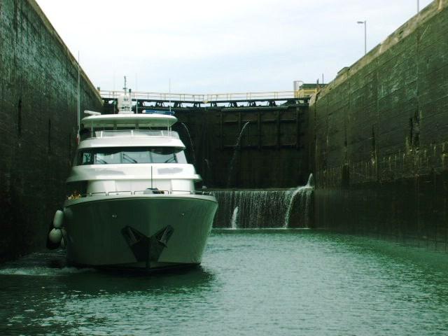
OK, 40 miles to Dunkirk. We decided to go to Dunkirk rather than the longer 60 mile run across the gut of the lake directly to the Welland Canal. This will leave us a mere 20 miles to do tomorrow. The day started like many with our wind meter pegged at zero. Some gentle rollers coming off our port quarter but no wind with them. We tried to keep a little pressure on the main but it was hard with the boat rolling as it was. So, we settled in for what might be a long day on the iron genny.

We were excited to see new shoreline. Unlike the Lake Michigan shoreline the shoreline here has stuff behind it! Hills and what not. Us flatlanders from the Prairie State get pretty excited about this sort of thing.

About half way through, the wind finally arrived. Probably 10-15 kts from our port quarter. Just enough angle for us to sail directly toward our goal at 6+ kts and turn off the engine. Nice. We man the helm on two hour shifts (“Otto” the Autohelm is suffering from schizophrenia) On Scott’s second shift we made nearly 13 miles! Nice.

The barge at left is our 'view'!

We found our way to what we figured was the ‘nice big’ harbor according to the charts. It’s not. Gomer and granny Clampet were manning the gas dock and while I did most of Gomer’s work for him our stop still took about 45 minutes for fuel, pumpout, and arranging for a slip. The piers themselves are floating metal carnival rides! Sue jumped down on one as we docked and it rocked back and forth about 45 degrees. Wheeeeee! I asked one of the worker dudes how far to walk to get some beer and snacks. He pointed to the street and said, “two blocks”. OK, just because I am fascinated with numbers…it was 9.5 blocks! Maybe he meant metric blocks.

We checked out a place called Walleye Willies (you’d have to right?) but they didn’t have food. Apparently the motorcycle gangs there had already eaten at the Denny’s. We checked out a “sports bar” that advertised food. Inside. . . whoaaaa! Maybe time to clean up the old spilled beer. The girl behind the bar with the nail through her lower lip brought us 2 paper cups of beer while we checked out other escape routes. Only one other guy at the “sports bar”. Let me point out that this is a sports bar with rap music played at max volume. We decided to NOT checkout the menu.

But, all is not lost. We found that the little place near the marina had an out side deck, food and a band! Imagine a mix of Bachman Turner Overdrive, Joe Walsh, and Rare Earth and you have this band. Fun though. Well, not every destination is pristine anchorage like Presque Isle. There are going to be the Dunkirk’s also and they’re good for stories. On to the Welland Canal tomorrow

A day on the hook in Presque Isle, PA


We left our slip in Erie PA pretty early in the morning. Just coffee and off we go. We simply motor across the big bay to a smaller bay called Marina Lake. It’s not really a separate lake but a well protected bay with its own marina surrounded by the Presque Isle State Park. We plan to just anchor here for a day and explore. Maybe claim the land in the name of Chicago!

There are two other sailboats anchored and we give them plenty of room and anchor by a little inlet the leads to who knows where? The anchor is set easily enough and we are off in the dingy but just oars. Good thing. There is a sign by that little inlet that says no internal combustion engines (Oh for a steam engine just then!). We (Ok, Scott because he insisted) rows the dingy up the small channel. It’s very wild and pretty and we go as far as a bridge and pull the dingy up to begin walking. We have a map of the state park and follow the walking, biking path all the way to yet another memorial for Commander Perry. It seems his ships were all built right here in Erie for his famous battle of Lake Erie that was alluded to earlier in this blog. In fact the two bigger ships were built here but could not make it through the shallows so they had to use “camels” to get them out. It is just crazy what people did 200 years ago. A camel is a big square barge type thing. You place one on each side of the ship you want to clear the shallows and then you sink the camels! Tie the big ship to the camels now nice and tight. Now just pump all the water out of the camels and you raise the big ship so it can clear 4 feet of water! Of course before you do all that you take off all the cannons and cannon balls and Elizabeth Taylor if she is hiding below and then you put it all back sans Liz!

Anyway, right where this Perry monument is is where they scuttled (sank) the Niagra and some of the other ships from the battle of Lake Erie in a place called Misery Bay. Way back in 1914 though they raised the Niagra and used the keel to build an exact replica of the original ship. That very ship sails out of the Maritime Museum here in Erie PA.

A shot of Misery Bay....doesn't look so bad now!


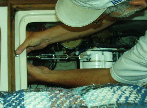
In the afternoon Scott read and Sue did some boat projects: cleaned the fenders and sewed some reinforcement into our hatch screen. Good thing because later in the evening we really needed the screen to thwart the mosquitoes…well, most of them.


We took dingy out again later and tried to catch dinner with our usual outcome. A couple of strikes but no fish. We were on the look out for gar since we saw one as we anchored. Thankfully none were to be found while fishing.

Tomorrow we leave early and either head for Dunkirk, NY or the Welland Canal in Ontario depending on the winds.

See the Gar fish? Yikes! Gots a big aligator type snout!

Tuesday, July 19, 2005

By the Southern Shores of Lake Erie

Intro...
First off, if you had Lake Erie in the Gracie Dead Pool you may not win! Secondly, thanks to all who email and comment. After a few days being on the go it is so great to find some internet access and read mail. Keep it up and understand that when we don't answer right away we are still searching for a connection. For example, there was no way in Ashtaboula. They still seemed pretty excited about the light bulb! Thirdly, I'm still getting used to how blogger handles pics and text so some things may be a little confused here but the library lady is about to throw me off so FIGURE IT OUT! Lastly, Thanks to my wonderful daughter, Leah for putting in the little updates and making the charts and arrows.


Hello to all our friends and fellow sailors! Wow, it's been awhile since we have been able to have internet access. Since our last update we have covered much of the southern shore of Lake Erie. We left Detroit and had a long motor down the Detroit river which then leads into Lake Erie. From there there were many choices depending on the wind. We could have gone as far north and east as Pelee Island or as far south as South Bass Island and Put-In Bay. After checking the wind direction we realized that the entire chain of islands was in our NO-GO zone. Such is sailing! After a bit of tacking and hoping for a wind change we got it and had a great reach all the way to Put In Bay! We took a mooring ball ($27 with free unlimited tender service!) just before dark.

Put-IN Bay is very touristy and features the big Perry Monument marking the US victory over the British in the war (ok let's face it, it was really just a skirmish) of 1812. Hard to believe that big old wooden sailing ships fought a vicious naval battle just a few miles from these summer islands! We stayed a couple of days and relaxed and explored around a bit. Good food store right down town and that's always good for us. Also had a good wireless signal and pictures shows me writing from the park.


This is the view from the top of the Perry Monument. Can you find Enee in the picture?


The Perry Monument. Impressive and built out of individual hunks of stone.


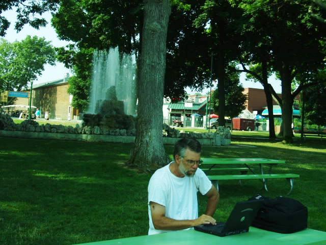
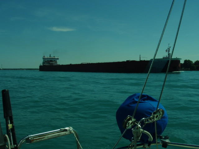
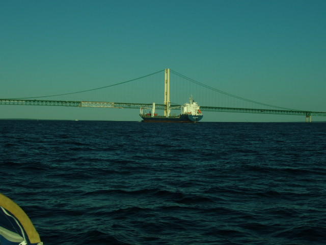
From Put In Bay we sailed to Sandusky, OH. Why? Because we could stay at the Sandusky Sailing Club for FREE thanks to Mark S. of SSC. Picture shows one of the many work boat/freighters we are constanly sharing the lakes with. This one was in great shape with a snappy paint job.

The approach to Sandusky is interesting as you can see the big scary roller coaster from several miles out. From about a half mile out you can begin to hear the people screaming. My screams from several years ago can still be heard echoing off the lake!

From Sandusky we sailed to Lorain OH. Friendly little harbor with a little resturant right there. We were entertained by an amazing magician (ok we are easily entertained after 10 hours of staring at the horizon!) and met a fine lady named Sally who informed us that the most famous person EVER from Lorain, OH is Father Guido Sarduchi from Saturday Night Live fame. That was a fun night but never say Jagermeister around me. EVER!


Yeah....Leah made me go on this ride...ONCE! I never wore THOSE pants again!


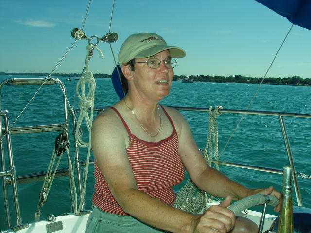
Yes is it tough duty being at the helm for a 2 hour shift. Some things help to pass the time and keep the flies away!From Lorain we motor sailed across the big bay that goes into Cleveland and made it to Fairport where there is a big area behind their sea wall to anchor. Just a stop and go for us as the next day we were up and on it and made another jump to Ashtaboula. Don't ask either of us to be able to say it or spell it!


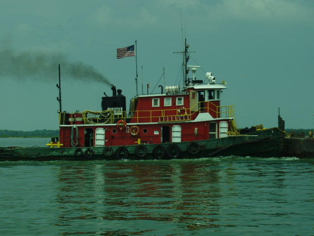
Like a lot of towns along this coast it is very industrial. Instead of going under a big highway bridge you go under a big coal conveyor! There is a very neat draw bridge that opens on the half-hour like most bridges on the great lakes. We were completely dumped on by a hard rain as we entered this channel. A sailboat in front of us helped lead us past the draw bridge, around the shallows and to a tie-up at the Ashtaboula Yacht Club. Thanks to my friends at Burnham Park Yacht Club...the Burgee Works! Our tie-up was right across from this white old work boat called SONNY II. You can pull up to that big open window and Sonny will sell you...anything! Beer, snacks, hot dogs, etc. What a hoot. One of the yacht club people said is was a "bum boat". He can go out and sell groceries and what not to the freighters. I think mostly he stays tied up in the river selling us cans of Labatts for a dollar! We toured the river in dingy and enjoyed our Labatts.


This is the neat old lift bridge on the Ashtaboula River.


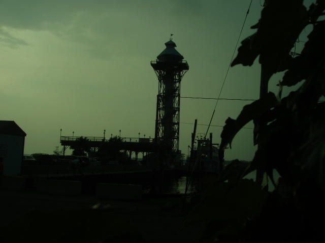
Like many of our days on this lake with the weather pattern we were in we found we could make a 'run for it' in the morning and then better find harbor before thunderstorms popped up in the PM. This was exactly what we did yesterday making a jump from Asta..$#$#% oh you know!to Erie PA. About a hour after we made harbor, thunder and lightning and high winds came on again. Glad we were tied to a pier for that one!

This is the observation tower in Erie PA giving a panoramic view of Presque Isle. We hope to get out of this marina and go anchor by the state park later today.

We may spend a day or two in this area. There is a maritime museum with a mock up or the rebuilt Niagra. This was the ship that Perry jumped to in his defeat of the British. I'd like to see that. From here we go across the lake to the Canadian side to get into the Welland Canal which will take us to Lake Ontario.

7/18/05

Almost off the map!!! Yowza!

Scott and Sue made it to Erie, Pennsylvania yesterday. They are planning on staying there today and looking around town for some internet, getting provisions etc.

Stay tuned for good stories from Scott and Sue, and a new map the next time they move!

Sunday, July 17, 2005

7/17/05

So I bet everyone wants to know what happened between 7/11/05 and 7/17/05. Well Leah has been busy and when Scott calls and tells her that he is in "fill in the blank" she goes ok, and then can't remember where that was. Fair banks? Fairview? Anyways, I do know that they made it to Ashtabula today...guess what, I can remeber that name! They are having a fine time but are in technology hell as they can't seem to find internet anywhere to update their faithful followers. So keep staying tuned as great adventure stories are sure to come soon.

Saturday, July 16, 2005

New Map

Hi everyone-

I was searching through Google the other day to look for some maps, and I found these new ones that I thought might be a bit better for this website. It's a bit bigger and unlike mapquest the roads are not displayed all over the place. Scott and Sue are almost off the map though so stay tuned for new maps and of course new adventures!

Tuesday, July 12, 2005

SOME RANDOM THOUGHTS/PICS FROM SARNIA TO PUT IN BAY


Here's the finished product on the engine. The turnbuckle allows for infinte (ok within limits!) adjustability for the belt tension. No more sockets and giant screw driver to adjust belt tension. I can do it with one hand tied behind my back!


Here is one of the many ships we shared the river with. They are quite impressive and you KNOW they can neither turn nor stop!


We will NEVER miss a buoy with Sue at the helm. She can spot a 2 foot high can buoy at 3 miles in dense fog! Red right returning, right? Wait are we returning or coming...or going? ARGGGGGGGGG!!!!!!!!

Sarnia, Ont. to Put In Bay, OH


A rough ride down the river - Not because of the big boat though but all those power boaters! What is the stinking hurry?


AT the left is Sarnia Marina: something from the 1950's ...or the 30's with the art deco motiff.

Sarnia to Detroit:
Our 1 day stay over in Sarnia was very nice. We left the gas dock on Sunday morning around 8:30 a.m. rested and ready for the trip down the St. Clair River. Sailing a river is a new experience for us. Actually there is no sailing, just motoring. We shared the 1/2 mile wide river with freighters and a gazillion power boats. The freighters were awesome in their size and structure leaving some of the calmest wakes imaginable. The power boats were loud, fast, and obnoxious leaving some of the wickedest wakes to maneuver. Where were all these power boaters going anyway. It was a hot sunny summer Sunday, but this was ridiculous! As we left the river and openned up into Lake St. Clair, we saw hundreds of boaters all anchored off one beach. How fun is that. And in a few hours they would all race back up the river against the current. Oh well, they have power to burn.

The St. Clair river opens up into 20 mile wide Lake St. Clair. Yeah, 20 miles wide and 17 feet deep! What a weird lake. Once again we motor-sailed along with the big boys and then followed the buoys into the Detroit River and downtown Detroit. Many Marinas along the Detroit shore and we ended up at Harbor Hill in the Hood Marina....a-how, how, how, how.


Leaving Detroit

Up at 0515 for a 0600 start. I do my usual checking of belt tension and discover that about 8 inches of the inner rubber toothed part of the belt has been peeled off! Nice. I think I know when this happened too…Part way across our motoring Lake St. Clair I realized that the selector switch was set to charge the starting battery only but not the house bank. We had been on it for several hot hours with the frig running so I switched the selector switch to all. This put a sudden load on the alternator and mechanical load on the belt and I bet right at that moment the belt dug in and got its teeth ripped out!

Looks like NOT a 0600 start. This could turn into one of those nightmare days where you are wandering all over some strange city (Detroit!) trying to find just the right belt. Now, I DID have a backup belt but none after that plus the backup belt was just a bit long. When I pivoted the alternator all the way to the dead end of the support bracket the belt was maybe tight enough but there was going to be no tensioning it after that. We considered our options.
Certainly it was too early to actually find a belt somewhere. There were a number of marinas around though so finding one should be ultimately possible. Also possible is that we have to make the boat go a ways on the longish belt to get more backups. Hmmmm…I remembered a picture in Calders book That showed an alternator being tensioned with a turnbuckle rather than the usual slotted bracket and screw. I dug through my sailing hardware box and came up with a nice big old turnbuckle! What was that from? I discovered that it would reach from the screw in the alternator horizontally over to the underside of the port settee. A few minutes with my trusty cordless drill and some random nuts and bolts and viola! I can now use a bigger range of belts!

Let’s face it, when you are cruising you can’t always find just the right part but only come close. This modification allows for close being OK. I can now tension the belt with one hand and then put a wire through the turnbuckle screw and body to keep it from backing off. But still would like some back up. We’ve had a bad history with belts. I walked back to the boat yard part of the marina and found Mike who said the shop would be open soon and they might have a belt. He said he’d come around 9 or so when they were open. Sure enough Mike came down to our boat to get me. Get me indeed! He gave me a free golf cart ride way back to the shop which is called Shipwreck Boat Works. I showed the lady there my belt and asked if she had one or two like it. A few minutes later she came back and said no but I was welcome to dig through their collection of old belts! Sure! Who says cruising isn’t exotic. There I am on a upper floor of a big old nasty boat shop looking at hundreds of belts hanging randomly from the wall. I am in belt heaven. I pick a couple that I think will work and Mike gives me a ride back to the boat. Turns out that one worked and the other not so back to the shop to pay up and maybe find another like the one that fits. In the belt graveyard I did find another. This is sweet. I now have 3 belts! I find the lady to pay up and she says, "Hey, those are all used belts. Just help yourself." Cruising is full of surprises. Friendly people are everywhere and mostly people are interested helping once you tell them what you are up to. Downtown Detroit is no different. So, if you find yourself in trouble in Detroit (boat trouble that is) look for help at Shipwreck Boat Works and Harbor Hill Marina.

Monday, July 11, 2005

More changes

Hey all -

Jason again. Observant readers out there in blog-o-land will hopefully have noticed that the site has gone through a few iterations. I think the look of the site is finally finalized. Hopefully now the text will resize to fit any web browser and will be readable as well. Once again, if you notice any glitches, drop a comment.

-Jason (html master general)

Saturday, July 09, 2005

Goodbye Lake Huron

As the red arrow will soon show we have left Lake Huron! We are currently in Sarnia Ontario on the St. Clair river across from Port Huron, Michigan. From Rogers City we had to wait for fog to clear. Around Noon we finally left and just made a short hop to Presque Isle. This is a nice forested anchorage. There were about 6 other boats anchored there as well including friends we made in Rogers City: Ann and Andy! I guess we are following them. We love to anchor. There is so much less hassle than finding a marina plus, anchoring is so FREE!

From Presque Isle we sailed to Harrisville.. . . and so did Ann and Andy! This had to be the Mayberry of Michigan. WE were the youngest people in town and the entire town was down at the band shell for some really great music ala Lawrence Welk. But, they had a food store and that is always a plus for us on foot.

Harrisville behind we made the long jump across Saginaw Bay. We started out sailing but the wind pooped out and the day became a long motor-sail for us and our friends the FLYS! Yuk. Down the coast a ways after you cross Saginaw Bay we found good anchoring in Harbor Beach. There is a large wall and a power plant and you can anchor just inside that wall. Guess who else anchored there? It was fun to talk with Ann and Andy and learn from them ideas about anchoring for some of the rest of our trip.

Yesterday we left Harbor Beach and, once again, not much wind so motored with the main up for any push we could get and made our way to the end of Lake Huron. As we entered the buoys that lead into the St. Clair river we noted a freighter coming up from behind. These things travel faster than you would think. Before we got to the river proper, we bailed and circled around to let the big boy pass. At the very end of the buoys you pass under the Blue Water Bridge and are officially in the St. Clair river. We found a marina just a half mile from the bridge...Sarnia Bay Marina. LOTS of empty slips but a pretty nice, art deco marina.

Today we are spending a 'shore leave day' in Sarnia to post this blog (Your Sarnia Office where Richard Mateer helped us do our computer stuff), maybe find some supplies, clean up the boat, fix the water tank and basically catch our breath for the next run. We will anchor somewhere on or near Lake St. Clair tomorrow and then down the Detroit River to anchor in Lake Erie the next day.

Thanks for any and all comments to the blog! When we are out of touch for a few days it is very exciting to look at the blog and see what's there.

Freshest Water


"I think they are trying to poison me with the water in my dish so I prefer the 'fresh' stuff. "
When a repair is in process, the boat is in turmiol. Eventually everthing finds its way back to its proper place or at least a place. While Scott was repairing the water tank, the cabin and cockpit became the 'holding tank.'

Life isn't so bad at sea, see.


Gracie finds some calm time to clean up. Then back to napping.

What are you doing in there? Nothing....


Scott works on repairing the fitting on the water bag, I mean water tank. I think......

Which one is the wienner?


Roger City has Plath's butcher shop with great steaks and cheddar cheese spread. And a few hot dogs.

What size prop can your shaft handle?


Sue wants a new prop this size for the new prop shaft. Scott says NO!

But What Does Sue Think?

It’s been just over 3 weeks of our sailing on and what does Sue think?

I wake up wondering about the weather. I love paying attention to weather. I worry about storms, high winds and waves, so I collect as much information about these things as I can. And then it’s time to sail ….. or not.

The few days we’ve actually sailed have been rather fantastic. Sailing (and motor/sailing) through the night from Lake Macatawa to Leland, Michigan was very exciting. Scott and I shared 2 hour shifts and I had the 2-4 a.m. slot. The stars were plentiful and when the almost full moon set, they became brilliant. It’s an amazing place to be; on calm waters about 5 miles off shore looking at distant lights, on the look out for passing barges, and listening to the water wash by the hull. I find it peaceful and exhilarating at the same time. Of course there are also the frightening moments when you start to think, what if there’s a rare species of monster fish living in these waters that no one knows about and they are about to crash into our boat! These moments come in handy when one is trying to stay awake when on watch at the helm.

I continue to be the more conservative crew member although I do like to adventure-on as well. In theory, taking the ‘short cut’ route to the Macatawa Bridge would work according to the charts. I looked at them. I agreed. The question I had later was, ‘Are depths measured from the highest rock or the lake bottom?’ An important difference to consider. But we paid close attention to what we were doing and when the depth got to 10 feet it was time to turn hard to port where we knew the deep part was.

This morning the question was, ‘should we go out today?’ It rained off and on all night, the temperature was changing and the fog was thick. We could barely see the 3 sets of buoys guiding the way in and out of the harbor. Perhaps we should wait until the fog lifts. The single handed sailor in the slip next to us said he wasn’t going to chance it in the fog, why would we. Instead we walked into town, tried to update our blog and checked our email. We also found a great butcher shop, Plath Butchers, and the last fresh baked loaf of white bread. By the time we walked back to the boat, the horizon was clear although there looked like white caps were forming. The fisherman that just returned from the north said that the waves were about 4 feet and seemed like they were building. Hmmmm. We walked over to the lake again to check it out ourselves. Looking south which was the direction we were headed, the lake looked rather calm although there was definitely a brisk breeze. We were going to have the better of the predicted 10 to 15 knots.

Scott said, “What do you think?” I said, “I think we should go.” And we did. Gracie didn’t like the chop we had to motor through to get away from the shore, and frankly neither did I, but once we were out a ways, I was steering a very comfortable, fast, though reefed starboard tack reaching 7 knots at one point. We don’t usually go that fast, but it was comfortable I think because Enee, the sails, the waves, and the wind were all in sync and I was able to be the one steering to make it happen. Scott asked, “Are you glad we decided to come out?” I said, “Yes.” (I won’t talk about how the wind died down to almost nothing when it was time for Scott to ‘drive’ and we had to put on the motor and grind to our anchorage.)


Sometimes I am afraid. Sometimes my fears are of the unknown like the monster fish or the unpredicted weather. Sometimes my fears are of the moment, like the height of the waves or the tangling of the leech line. For me, so far, these fears have been a chance to find out what I can do. And I think I can do a lot. But not everything. It’s about balance and being in ‘sync.’

When Gracie decided to pee in our bed, I wasn’t in control of that situation. But I handled it. When the waves grew to 6 feet when we were heading to Rogers City I wasn’t in control, but I handled it. Can I always handle everything that comes my way? I don’t know. But that is life. And I love it.

Sue

Sorry for the Delay

Hi Everyone-

I must apologize for the delay in updating the map. Been super busy this week at work with presentations and not much sleep. I will stay on it from now on, ok, well after i talk to my dad today and find out where he is because I can't rememeber even though i just talked to him last night. I do know that he is somewhere in Canada.

He is also back in Sprint land so talking to him on the cell phone will now be a bit easier.

As Always, stay tuned.

Friday, July 08, 2005

Work in progress

Hey all -

This is actually Jason speaking to you from beyond the Web. I wasn't granted the rights to post on this site, but I happen to have Scott's log in, so I'm posting anyway.

I just wanted to mention that the site is undergoing a visual overhaul to improve the general readability (bigger font, wider main column), but is a work in progress. It may appear a bit wonky on some computers until I get it all figured out. Hopefully this will all be fixed soon, but I figure, if the good ship Enee Marie got a week to figure out her problems, then this website should get at least that much time to work out the bugs.

Drop a comment below if you are having any troubles reading this (having to scroll side-to-side or something) and mention the problem and what sort of browser you are using (internet explorer, firefox, magna-doodle, etc...).

-Jason (keeper of the html)

Tuesday, July 05, 2005

7/5/05 Update

I heard from Scott and Sue today, although I could barely hear them through the cell phone static. I did make out that they have made it to Presque Isle which is a little bit north of Alpena. Yes I know, on the map above it looks like they have made it all the way to Alpena, but web girl can't do much about picture resolution.

They for reals hope to make it to Harrisville tomorrow. Stay Tuned!

By the way as you can tell from the picture of Scott below, yes you know the one, with the Old Style, sailor man is just about as happy as he can be. Go Go Sailors!

Gracie don't worry, we are all thinking of you.

Couple More Pics


Catching UP

Hi all. Scott and Sue had some problems posting at their last internet stop and so asked me to post their latest word of sailing wisdom and stories. Also they sent me some picture to show all of you. So enjoy and stay tuned for more.

The Sailors Say...
Catching up

Charlevoix to Mackinac Island

We left Charlevoix late Saturday morning July 2 heading for Gray’s Reef light which provides the passage through, oddly enough, Grays Reef. We found this just fine. Looking at the charts there are 2 green markers that will be on your right and there is Gray’ reef light and a red marker on your left. This is the main channel through Gray’s Reef. Two more green markers lead you another 1-2 miles north where you can turn and head East to the Mackinaw Bridge. Clearly this is only for very large boats. A glance at the charts will tell you that you can easily head just north of the old abandon light house and always be in water that is no shallower than about 15 feet.

Right.

Why does Sue still listen to my ideas? We rounded the second marker and headed 78 degrees which would take us safely north of the old light house. Boy, you know this northern water is sure clear. Near the light house I could see the bottom. Wow that physics thing where water looks shallower than it REALLY is is really coming into play. Man those are some really big rocks! How deep is it here?

HOLLY CRAP THE DEPTH SOUNDER JUST WENT TO 10 FEET! All stop. Turn north! Go Slow!.....

We never touched bottom and made it out just fine. I cooked AND did dishes that night.

The Mackinac Bridge is a beautiful sight and you get to sight it for a long time. Sue made the first sighting when we were 21 miles from the bridge! Because of it’s size you always think you are about there…but you are way off! As we approached the bridge from probably 3 miles off we noted a freighter coming from behind way back on the horizon. Surely we are going to beat him to the bridge. Wrong again! We nearly went through together which was really fun.

As we passed under the bridge I popped that big old 24 oz Old Style that Maria Hall gave me at the going away party. This is probably the last Old Style for quite a while. Passing the bridge marks truly entering new territory and gives as more of a feeling of adventure. I’ve spent my whole life within 50 miles of Lake Michigan. Time to move on!

We found our way into the harbor area on Mackinac Island easily enough. To the east side there is room to anchor although it’s also strewn with empty mooring balls. There was little wind so Enee just sort of danced around her anchor that night. When night fell we had a perfect view of the bridge which is lit up with red white and blue lights. At the distance of 5 miles the bridge looks like a construction by a crazed spider. It looks very delicate.

Mackinac Island to Rogers City

Up at 5 or so, coffee and a roll. Rig the boat and off we go! A pretty blue hulled ketch weighed anchor and left just before us. The wind had come up a bit and it looked like we could sail. We motored for a bit to throw a charge in to the batteries and headed south-west toward the shore of Lake Huron. The wind was south or south east and we hoped to use it to follow the coast through the south channel. This was a day of very interesting and fun sailing. As we hoped we sailed on a starboard tack taking advantage of a very nice off shore wind. Winds here are funny. Sometimes it would just stop. Then we’d motor for maybe 5 minutes and it would be back up to 10-15 knots. We raised and lowered sails and on and offed the motor many times but mostly we sailed at around 5 knots in the direction we wanted to go!

We were thinking about making Presque Isle which had nice anchoring we hear but knew Rogers City was another choice although no anchoring there. As the day wore on we decided to make for Rogers City as that would make for a 12 hour day and if we are not going through the night, a 12 hour day is plenty.

As we passed Hammond Bay we found our selves in strange waters. The wind was still off shore but large rollers were heading inshore indicating bigger wind coming from the south-south east. We tacked out to get an angle toward Rogers City which was now about 11 miles away and, yes, there was plenty of wind out here. The wind climbed to around 20 knots and the waves climbed to 4-5 feet with the occasional 6 footer. Ouch. We went out to where we thought we could make a run to Rogers City and tacked. We found we did best with full jib, reefed main and the engine on to help us power through the waves. With this set up we could maintain 5 knots even in these rough seas. Of course we came up short and had to tack out again…and again. This little 11 mile shot was becoming a real adventure. I stayed at the helm while Sue jumped around the boat trimming sails. On one tack the leech line from the jib tangled with the sheet making trimming the sail impossible! Sue went out there to reach out and grab the clew. She couldn’t reach it unless I went into the wind and luffed the sail but not too far as to get back winded. Easy enough in calm water but a little tricky in these waves with your wife leaning over the rail. Sue finally got a hold of the clew but couldn’t untangle it. I passed her my knife to cut the leech line which she did successfully.

We were adjusting to this mode of sailing and although uncomfortable we felt we could do it for another hour to make Rogers City. On the final tack we noted that the jib had frayed (again!) where it touches the spreaders. The seam had come out and the leech line was blowing way out away from the sail. We needed to get this sail in to prevent further damage. I was afraid that as we tried to roll it up the leech line would tangle on the spreader and then we’d never get it in and then really bad stuff would have to happen to make harbor. As Sue rolled up the sail I tried to make sure that we let plenty of sail out so the leech line would blow away from the boat and stay off the spreader. This worked and we rolled up the sail. We motored with some pressure on the main the rest of the way and made Rogers City around 7 pm.

Rogers City is a very nice and friendly little harbor. The kids at the gas dock are very polite and then they come over to the slip they’ve given you and help you dock. Not that I need help docking the boat but still… We met two cruisers while still at the gas dock making arrangements and another couple of cruisers are right next to us. Their information about Lake Huron will be very useful. Tomorrow we plan to stay the day and make repairs to our sail. Rough conditions make you re-think many of your procedures and how things are rigged so we will use a day to make some adjustments, maybe do some laundry and prepare for the next leg.

The next day we took the sail down and, wow, yes it was ripped up pretty badly along the leech for about 4 feet in the neighbor hood of where it flogs against the spreader. No major rips into the sail itself though so that’s a good thing. We had brought along plenty of extra sail material from old sails as well as new material from a sailmaking project a few years ago. We cut a sheet of new material 12” x 24”. This was folded down the middle to make two 12” x 12” halves. This fold went along the leech of the sail providing a 12 x12 patch on each side as well as reinforcement along the leech in this critical area. Over the course of the next two hours this patch was sewn on by hand. Fun. Not pretty but certainly better than it was. As a final step we stuck a 4 foot long piece of sail repair tape, folded over and along the leech of the sail. There was no good way to keep the leech line as part of the sail with this make shift repair so we cut it at the highest point of the tear.

Now for repairing the cause of the tear itself. The spreaders have metal bands around the ends to enclose the upper shrouds. While we had taped over the bolts that hold this on with rigging tape the metal bands were left exposed. What we really need of course are those nice spreader boots. Unfortunately we are in Rogers City with not car on the 4th of July. So we need something that will act like a spreader boot. Sue ventured into town and found the Family Dollar store and came back with a collection of rubber balls AND a pack of those small roller covers. We opted for the roller covers.

The roller cover was cut along its length to be able to open it up and stretch it over the spreader tip and around the shroud. Sue climbed into her bosun’s chair and was hoisted to the spreaders. Some minutes messing with rigging tape and we had ourselves two new spreader boots! Sure they’re not marine grade but then they came from the Dollar Store!

Next… Scott and Sue see how their repairs hold up under sail. Stay Tuned!


Monday, July 04, 2005

7/3/05 Update

Scott and Sue made it to Mackinaw Island on July 2nd and then onto Rogers City on July 3rd. They are really on it now....except....

They had a great sail from Mackinaw Island to Rogers City with the wind right where it should be to really sail, until the end when it got really rough. The bad weather tore up their sail a bit and so they are staying in Roger's City on the 4th of July to sew the sail (try saying that 10 times fast) and will be on it again tomorrow.

They hope to make it to Harrisville tomorrow.

Stay tuned for more sailing adventures.

Saturday, July 02, 2005

Enee's Bottom is WET!

Yes we are back in the water with a new prop shaft, cutless bearing, packing and collar! Right now the man is aligning the engine with the new shaft and we should be outta here in an hour or two. Depending on weather we will either head out today or tomorrow then. Stay tuned!