Barry returned our weather-check phone call at 8:00 a.m. Barry is our friend in Muskegon Michigan and fellow sailor. When in need of internet weather we call Barry and he relays what he sees to us. Scott talked with him about what details were available on-line about the Jersey shore, which isn’t much, then went back to bed. I, for a change got up and made the coffee. As I got comfortable in the cockpit with the computer, 5 small fishing boats and one large ‘trawler’ came into our anchoring neighborhood. They’re clamming with those long poles with baskets on the end. Now we can see how this really works….. I’ve got to take some pictures…..
1:00 p.m.
We’re back on board after checking out the yacht clubs and town of Great Kills. Many restaurants and a couple delis but no internet. Right now Scott is plotting our course for tomorrow. We plan to head as far as Barnegat Inlet about 50 miles south. This will be the first time we’ll sail so far in the Atlantic. Exciting and scary. We have our charts and NOAA weather radio, but we don’t yet have a good sense of what the sea conditions are like. What does it look like when the radio predicts waves 3 to 6 feet; swells from the southeast? Tomorrow we’ll find out. Although the wind is suppose to be from the west tomorrow. We think that’s a good thing.
Tuesday – Through Hell Gate and Beyond!
We checked and double checked the ebb and slack times at Hell Gate where they say the waves can get to be 6 and 10 feet if the conditions are just right. Our plan for the day was to sail from Port Washington in Manhasset Bay to Sandy Hook, which is past the V Narrows Bridge and just south of Statin Island. We left our anchorage at 11:00 a.m. and noted the multitude of boats, both sail and motor yachts, cruising on by us making their way through Hell Gate as well. We think we were the last sail boat through but our timing worked because the current, though evident in the swirling waters, wasn’t very strong and we were flowing with the tide. Our boat speed in the water was about 5 knots but the water was flowing about 3 knots in our favor so we were flying down the East River.
After dodging the many tour boats and ferries as well as freighters and other cruisers, not to mention tourist helicopters we passed Lady Liberty once more and were heading out to the Atlantic. Or at least a beginning piece of it. As we approached the V Narrows bridge Scott said, ‘Just let me know when you want to put up the main.’ I hesitated too long because as we cleared the anchored dozen or so huge freighters just before the bridge the wind picked up (it felt like 15 to 20 to me), right in our face of course – from the south and the waves were significant. The wind was blowing against the current which makes for tricky seas – like those tales of 6 to 10 feet at Hells Gate. Only this is the OCEAN! So we plodded on just with the motor past the bridge then picked a ‘lull time’ to raise the main. Much better now. Our speed picked up and for sure we’ll be able to pass across the freighter channel before that next one come by. Right? These ships are loaded with at least 50 train car size trailers stacked 4 or 5 high. Very impressive.
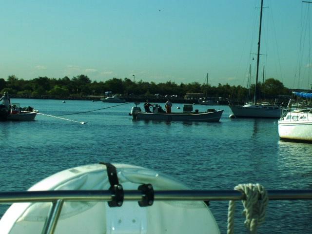
Once we got both sails out we had a beautiful sail heading west. So it was time to let the wind take us to the next place and we changed our destination to Great Kills instead of Sandy Hook. We snuck into the narrow channel where the sandy shore was a rocks through away and the depth got as low as 7.5 feet. Once inside the depths are 15 and 20 feet, except for an unmarked 3 and 5 foot shoal which becomes obvious since no sailboats or mooring balls are there. We headed to the northeastern part of this well protected ‘lake’ and anchored just past the boat ramp.
As we sipped our successfully anchoring Enee beer we realized all of the drama of the day: Pay attention to the tide and currents and don’t get caught ‘the wrong way’ and beware of the swirling water and don’t get turned around and watch out for the many floating debris in the East River like wooden doors and make sure you stay clear of the barges and freighters and ferries because they have the right of way and read the bouys correctly because you don’t want to get in the shallows! Let’s have another beer.
Last night we looked at the charts to make a plan for our next trek. The detail on the chart doesn’t include bouys in the channels of the few inlets between here and Cape May and some depths are charted as 2 and 3 feet. Can we really get into these places? Today when we went ashore we stopped into Mike’s Bait and Tackle store to find more detailed charts. There weren’t any but Mike told us that there’s no problem getting into Barnegat Inlet. It’s well marked and plenty deep. He’s been there with large yachts that draw 8 feet. Local knowledge is the best.
No comments:
Post a Comment